
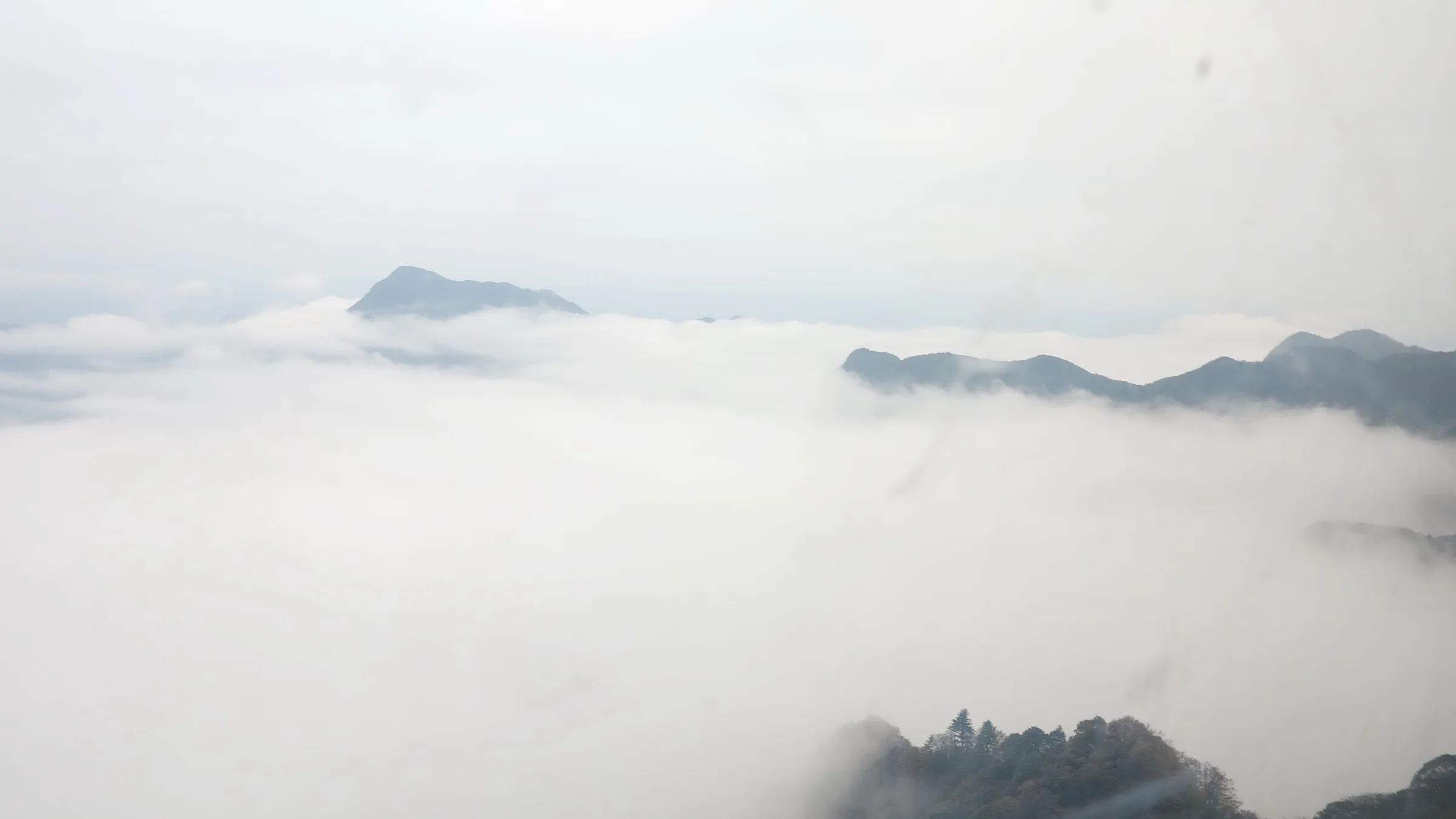

Cover image: A sea of clouds at Jinfo Mountain, photographed on 9 November 2014. Weather and visibility on another visit may be entirely different. Creator: Nyx Ning; Source: 重庆 金佛山 云海 - panoramio.jpg; License: CC BY-SA 3.0; Changes: Resized and converted to WebP; full composition retained.
Jinfo Mountain in 2026 suits a Chongqing mountain trip centered on karst cliffs, forest and seasonal scenery. UNESCO identifies Jinfoshan as a table-mountain component of South China Karst, added in 2014. Plan a full day or an overnight stay, choose your entrance before booking transport, and keep the walking route dependent on weather and current access.
Understand the landscape before choosing the trip
Jinfo is in Nanchuan District, with the Chinese name 金佛山. Save both the mountain and district names when searching or arranging a driver. “Golden Buddha Mountain” is a translation you may encounter; the name does not mean the visit revolves around a single giant outdoor Buddha statue.
The useful geological idea is a table mountain: a raised landscape with a comparatively broad top and steep surrounding edges. UNESCO’s South China Karst description places Jinfoshan among 7 component clusters and highlights its cliffs, ancient caves and evidence of the dissection of a high plateau. This is why the outline of the mountain matters as much as an individual viewpoint.
Our recommendation is to choose Jinfo when you want to spend time within a mountain landscape rather than collect a rapid sequence of city landmarks. It is a poor choice for an afternoon squeezed before a flight, or for a day when your group needs a completely predictable return without weather-dependent facilities.
Jinfo and Wulong also offer different geological experiences. UNESCO describes Wulong through its large collapse depressions, natural bridges and caves; Jinfo’s table-mountain form gives this trip a different emphasis. If the natural bridges are your main goal, use the separate Wulong karst guide instead of assuming the two names describe interchangeable excursions.
Choose the season by what you want to notice
There are 4 broad seasonal reasons to consider Jinfo. The Chongqing government’s June 2026 introduction associates spring with rhododendrons, summer with a mountain retreat, autumn with forest color and winter with snow scenery. These describe recurring attractions, not conditions promised for a particular date.

Vegetation at Jinfo Mountain, photographed on 9 November 2014. This dated autumn scene shows grasses and a wooded backdrop; it is not a rhododendron-bloom or present-day foliage report. Creator: Nyx Ning; Source: 重庆 金佛山 芦花 - panoramio.jpg; License: CC BY-SA 3.0; Changes: Resized and converted to WebP; full composition retained.
Spring: flowers with a flexible date
If rhododendrons are the reason for the journey, ask for a current flowering update for the route you intend to visit. A photograph from another year can help identify the setting but cannot tell you what will be blooming when you arrive. Keep the booking flexible if the flowers matter more to you than the mountain itself.
Avoid making the whole day depend on reproducing a close-up flower photograph. A forest walk and geological viewpoint can still be worthwhile when flowering is less extensive than expected. Stay on the permitted path rather than stepping into vegetation for a composition.
Summer: compare mountain and city forecasts
A municipal August 2026 seasonal report describes a cooler mountain environment than downtown Chongqing. That is a reason to compare forecasts, not a reason to leave rain protection or a layer behind. The temperature you experience will depend on elevation, weather and exposure.
Choose a route you can shorten if weather deteriorates. A long journey to the entrance should not become pressure to continue onto an uncomfortable or closed section. Pack for the conditions expected on the mountain rather than the temperature at breakfast in the city.
Autumn and winter: scenery changes the practical questions
For autumn foliage, seek a current photo or notice with a visible date and named location. Treat a seasonal publicity image as an illustration of possibility. Color can differ across the mountain, and an image does not establish that its viewpoint is on your intended route.
For winter, ask about the condition of paths and access roads as well as whether snow is present. Snow viewing and skiing require different plans; this guide does not confirm an operating ski area, rental stock or lessons. If snow sports are your purpose, verify the specific facility and package before booking the rest of the trip.
Select an entrance before buying a ticket
The practical planning distinction is between the West and North approaches described in travel sources. Save 金佛山西门 for the West Gate and 金佛山北门 for the North Gate, then check that your booking uses the same entrance as your transport arrangement. Do not let an attractive headline price decide the route by accident.
TravelChinaGuide’s page, dated January 21, 2026, describes the two approaches and their separate cableway arrangements. China Discovery’s route discussion also distinguishes entrance products. These are useful orientation sources, but their operational details have not been confirmed against a current operator notice.
Before paying, ask about 3 components: scenic admission, any required internal shuttle and the cableway journeys your route needs. Confirm whether the ticket covers a return on the same slope, whether a different exit is permitted, and what happens if a facility is suspended. A mountain admission ticket should not be assumed to include every ride or activity.
The West approach is described around Bitan Valley, also translated as Azure Stream Valley, and the western cableway. It is a sensible option to investigate if that combination matches your interests. The North approach should be chosen deliberately for its current route and transport connection. Neither description here establishes which approach is operating more conveniently on your date.
Do not plan a crossing between entrances merely because a map shows a connecting path. You would also need confirmation that the route is open, that your group can complete it, and that return transport is arranged from the correct side. For a first visit, our planning preference is a same-entrance return unless a verified alternative has a clear advantage.
Organize transport around the return journey
Think of the day as 2 linked plans: reaching the correct entrance and getting back from that same place. This guide does not quote a city-to-mountain travel time because no current end-to-end route was verified for a specific starting point. Nanchuan district geography alone is insufficient to calculate your journey.
If arranging a car or tour, request the exact collection point, mountain entrance and return meeting point in writing. Ask whether waiting time, parking or route changes affect the quoted total. The Chongqing taxi and ride-hailing guide provides broader context for arranging a vehicle; it does not establish that an immediate return ride will be available at the mountain.
For public transport, check the current service to Nanchuan and the onward connection to your chosen gate separately. Old travel pages contain detailed bus times and fares, but repeating them without operator confirmation would create a false sense of certainty. Resolve the return service and a workable fallback before departure, especially if the final connection depends on another bus.
Ask your accommodation or transport provider to help confirm unclear Chinese names. Keep the meeting pin, entrance name and contact details available offline. The maps and navigation guide explains how to compare a destination pin with the actual access point.
A day trip makes sense when the outward journey, mountain time and return all fit comfortably together. An overnight stay is worth investigating if your plans otherwise depend on rushing a descent. Verify the accommodation’s location relative to the entrance; a property described broadly as “Jinfo Mountain” may not solve the access problem you are trying to avoid.

Tianxing town at the foot of Jinfo Mountain, photographed on 8 November 2014. These are modern traditional-style buildings; the image is not a cableway-station view or evidence of current accommodation availability. Creator: Nyx Ning; Source: 重庆 金佛山下 (仿古)天星小镇 - panoramio.jpg; License: CC BY-SA 3.0; Changes: Resized and converted to WebP; full composition retained.
Build the mountain visit around a small number of priorities
Choose 2 priorities rather than trying to include every attraction named online. A useful combination might be a geological viewpoint and a forest section, with a temple stop if it fits the confirmed route. This is an editorial framework, not a validated walking loop.
On arrival, ask staff to identify open paths on the current map and show where the return begins. Record the last descent and the time by which you should reach its queue. Your personal turnaround needs to leave room for slower walking, rest and any wait; a posted closure time is not a target for leaving the furthest viewpoint.
The municipal introduction identifies places including Bitan Valley, Qianniuping and Jinfo Temple. These names provide context when reading a map. They should not be assembled into an itinerary without checking their current connections.
Travel accounts also discuss cliff paths and Ancient Buddha Cave. Treat cave access as a separate question: whether it is open, how it is reached, what is included and whether the route suits your group. A geological reference to caves is not permission to enter an unstaffed opening or leave a marked route.

A cave interior at Jinfo Mountain, photographed on 15 September 2014. This historical image does not establish a current opening, ticket inclusion or suitable access route. Creator: Shallowell; Source: Jinfoshan - 0177.jpg; License: CC BY-SA 3.0; Changes: Resized and converted to WebP; full composition retained. This image does not establish the specific cave name Ancient Buddha Cave.
On a viewpoint, take time to understand what you are seeing. Look for the relationship between the forested upper landscape and the abrupt edge below it. There is no need to assign an age to every visible rock or repeat an uncertain local legend as geological fact. The mountain’s shape is already a useful starting point for observation.
Walking exposure, mobility and a sensible packing plan
Ask about the entire route, not just the first 100 meters beyond a cableway station. A cableway-supported trip can still involve walking, steps or an exposed-feeling section. We have not conducted an accessibility inspection and do not describe Jinfo as a continuous step-free outing.
If anyone dislikes heights, ask specifically about cliff-edge paths before committing to a loop. A photograph can show a walkway’s setting but does not establish how that person will feel there. Agree that turning back is acceptable, and ask whether a shorter route avoids the section that concerns them.

A cliffside passage at Jinfo Mountain, photographed on 15 September 2014. This historical image does not certify current guardrails, path opening or accessibility. Creator: Shallowell; Source: Jinfoshan - 0216.jpg; License: CC BY-SA 3.0; Changes: Resized and converted to WebP; full composition retained.
Carry footwear appropriate for walking, drinking water, food that covers a delayed meal, rain protection, a warm layer and backup phone power. For a winter visit, obtain current advice about footwear and path conditions before arrival. Do not assume that equipment will be available to rent at the point where you need it.
Keep 2 practical checks in mind throughout the day: how comfortably the group is moving and how much margin remains before the confirmed return. Shorten the walk when either deteriorates. If a path is closed or staff direct visitors away, follow that instruction rather than a saved route from social media.
Leave plants, rocks and wildlife undisturbed, and take litter out. UNESCO’s heritage description emphasizes both the geological landscape and its natural vegetation. Visiting a protected landscape is a reason to keep to appropriate access, not a reason to seek an unmarked shortcut for an uncrowded photograph.
About This Guide
Research was completed on October 1, 2026 using 6 distinct source domains. UNESCO supplied primary geological context; Chongqing government pages supplied seasonal and place information. Independent travel sources were used cautiously for orientation, with older fares and timetables excluded. No onsite visit, interview or measured walking time is claimed.
Current entrance arrangements still require confirmation before travel.
Frequently Asked Questions
Q: Is Jinfo Mountain the same place as Wulong? A: No. Jinfo Mountain is in Nanchuan and is a table-mountain component of South China Karst; Wulong is a separate component known for features including natural bridges. Choose according to the landscape you want to visit.
Q: Can I visit Jinfo Mountain in one day from Chongqing? A: Consider a 1-day visit when confirmed outward and return transport leave comfortable mountain time. An overnight plan may suit you better if the day would otherwise depend on a rushed descent.
Q: Should I enter Jinfo Mountain from the West or North Gate? A: Choose the entrance that matches your confirmed route, ticket and transport. West and North approaches have different cableway arrangements, so check the return side before paying.
Q: Will there be snow or rhododendrons when I visit? A: Official descriptions associate Jinfo’s spring with rhododendrons and winter with snow. Check a dated local update for your route; a general seasonal description cannot confirm conditions on a particular day.
Q: What is the current Jinfo Mountain ticket price? A: This guide does not provide an unverified current fare. Check the chosen entrance’s dated offer and confirm its 3 main components: admission, any required shuttle and the cableway journeys you need.
Traveler comments
Share a recent experience or ask a practical question about this guide.