
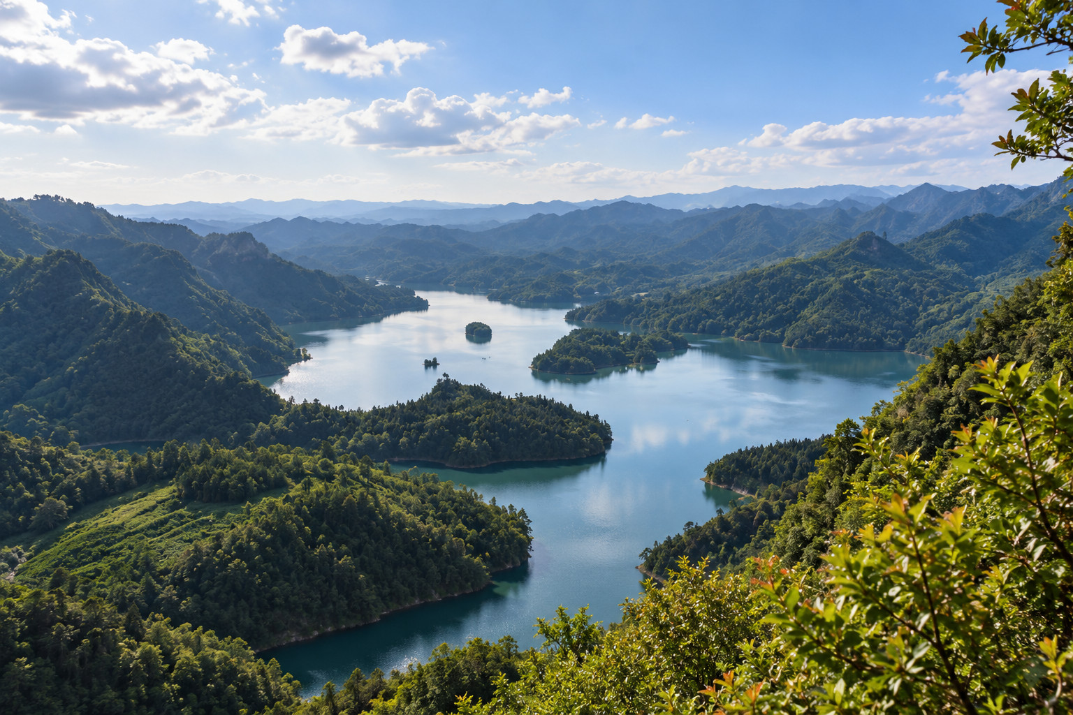
Cover illustration: AI illustration based on a historical photograph. Qianjiang Xiaonanhai lake and enclosing mountains; the historical waterline does not establish today’s conditions. Scene, terrain and architectural details are approximate; not a current photograph, access confirmation or navigation guide.
Historical reference only; original photograph not republished or licensed for reuse: Qianjiang District Government / Photographer not credited
This guide contains four explicitly labeled AI scene illustrations from historical photo references and one original localized planning diagram. Photograph capture dates and current access are not established by the page update dates. No independent review is claimed.
Xiaonanhai in Qianjiang is an earthquake-created lake to approach as a protected landscape in 2026. The district's official account dates its formation to 1856 and records the removal of lake boating after environmental-protection measures. Plan around a currently permitted shore visit, with access confirmed before making the regional journey.
The lake's attraction is the relationship between water, displaced rock and the surrounding slopes. Understanding that relationship makes a visit more interesting than simply collecting a blue-water photograph. It also helps avoid a common planning error: treating every older picture of a boat or exposed boulder as an activity available today.
Save 黔江小南海 and 小南海地震遗址 when checking the destination. This is Qianjiang's lake, not an unspecified place elsewhere carrying the Xiaonanhai name. The route ideas below are observation prompts for whichever public areas are open, not an assertion that a complete circuit has been surveyed.
Start with the origin rather than a scenic nickname
An iChongqing account published in June 2019 describes an earthquake-induced landslide blocking streams in 1856. Water collected behind that obstruction to form the lake. That sequence is the essential idea: the landscape records a sudden change in drainage, rather than the construction of a conventional recreational reservoir.
The district's more detailed profile identifies preserved landslide surfaces and earthquake debris among the features of the site. Use those categories to read the scenery. From an authorized viewpoint, look for how the slope, rock accumulation and water fit together, then compare your observation with the interpretation provided locally.
Do not assume every large rock visible from shore can be individually dated by sight. Nor does a picturesque island explain the whole event. If geology is the main reason for your visit, ask whether interpretation panels, a guided explanation or an exhibition are available on the day. Photograph readable labels where permitted so you can separate named features from guesses afterward.

AI illustration based on a historical photograph. Xiaonanhai wooded island and mainland shoreline; no island access or boat service is established. Scene, terrain and architectural details are approximate; not a current photograph, access confirmation or navigation guide.
Historical reference only; original photograph not republished or licensed for reuse: Qianjiang District Government / Photographer not credited
Understand why boating is not part of this plan
The Qianjiang Culture and Tourism Commission's profile, visibly dated 11 February 2026, discusses nature-reserve and drinking-water-source protection. It says lake boats were removed following environmental rectification in 2018 and 2019. The page retains older statistics, so its display date should not be mistaken for a daily operating notice.
The responsible planning conclusion is straightforward: do not buy a trip on the assumption that sightseeing boats, water sports or island landings are part of the visit. A seller offering such a product needs to establish exactly what it is, where it operates and whether it is currently authorized. A photograph alone is insufficient evidence.
This caution is not a claim that every form of shoreline visiting is closed. It is a distinction between landscape access and activities on protected water. Confirm the entrance, open visitor areas and any restrictions with the responsible local venue or district tourism channel before setting out.
There is no reason to test the boundary yourself. A gap in a fence, a disused landing or an old track does not create permission. Keep the outing on the route staff and signs identify, even when an older online itinerary suggests a more ambitious circuit.
Use a short observation sequence on the permitted shore
The district's March 2023 landscape account provides geological context but does not publish a verified current walking circuit. Rather than inventing a kilometre count, use a three-stage method that can be adapted to the open public route.
First, orient yourself at the entrance. Establish where you may walk, which way returns to your pickup point and where the facilities your party needs are located. Ask whether any section requires steps or uneven ground, and whether the route is out-and-back. A line visible beside the water on a map may be a road, a restricted track or a path that does not continue.
Second, choose a permitted view that reveals the lake and its enclosing slopes together. Spend time understanding the shape before taking close-up pictures. Third, look at an identified geological feature or interpretation panel, if one is accessible, and connect it to the larger view.
This gives the visit a purpose even when access is limited. You do not need to reach every rock or island to understand the landscape. For a family, asking each person to notice one sign of how water and land interact can be more useful than racing along the shore.

AI illustration based on a historical photograph. Exposed earthquake boulders from a historical low-water report published in 2023; not evidence of current drought or permission to enter the lakebed. Scene, terrain and architectural details are approximate; not a current photograph, access confirmation or navigation guide.
Historical reference only; original photograph not republished or licensed for reuse: Qianjiang District Government / Photographer not credited
Separate water-level history from what you will see
Xinhua's 13 February 2023 photo report recorded an 8–9-metre fall in the water level during dry conditions, exposing rocks normally submerged. The photographs, credited to Ye Xingjian, are valuable records of that episode. They are not evidence that the same rocks will be exposed when you arrive.
Think of two different questions. What does the historical material teach about the lake? What can visitors currently observe from the legal route? The first can be answered with dated reporting; the second needs recent information and conditions on the day.
A low-water photograph can also conceal the difficulty of reaching its vantage point. Exposed shore is not automatically a usable path, and visually solid ground is not a substitute for an authorized route. Do not follow footprints into mud, climb unstable-looking debris or approach the water to reproduce an old composition.
If photography is your priority, choose a flexible subject: the relationship of shoreline and hill, reflections under the actual light, or an interpreted rock feature within reach of the visitor area. That is more reliable than traveling for one exceptional water level. Keep captions honest about when and where the picture was made.
Decide whether the regional journey fits your interests
The official town profile places Xiaonanhai Town northeast of Qianjiang's urban area. The useful distinction is between arriving in Qianjiang and reaching the specific lake entrance. This guide does not supply a 2026 bus number, fare or transfer time because none was reliably confirmed in the research.
For an independent trip, verify three separate arrangements: arrival in the region, transport to the open visitor entrance, and the return. Give the provider the full Chinese place name and entrance pin. Ask whether a driver will wait, return at an agreed time or drop you somewhere with a separately confirmed onward service.
If you are passing through Qianjiang with luggage, resolve where it will remain before adding a shoreline outing. A scenic entrance should not be assumed to offer storage. Keep enough flexibility for a slower road journey or a shortened visit without risking an onward connection.
The railway-stations guide and maps and navigation guide cover wider travel preparation. They cannot replace a confirmed last connection to Xiaonanhai. If you have very little regional time and geology is a minor interest, a destination closer to your existing route may make a more satisfying day.

AI illustration based on a historical photograph. A historical-reference spring flowering field beside Xiaonanhai; not a verified visitor path or evidence of current blooms, water levels or access. Scene, terrain and architectural details are approximate; not a current photograph, access confirmation or navigation guide.
Historical reference only; original photograph not republished or licensed for reuse: Qianjiang District Government / Photographer not credited
Keep the Thirteen Villages as a separate decision
The district's 2026-displayed profile describes Xinjian Village and the Tujia Thirteen Villages area separately from the lake. Their cultural interest can complement landscape interpretation, but the shared Xiaonanhai town name does not make them one entrance or a short extension of the same lakeside walk.
If you want both, ask for a complete route proposal that names each stop and the transport between them. Check which public cultural spaces are open and whether any demonstration is scheduled. Leave room for a meal and the return rather than assuming that a combined tourism description is an itinerary.
Treat the villages as lived places. Stay on public routes, ask before entering a home or workshop, and request permission before making close portraits. An old description of traditional culture should not be used to suggest that residents are unchanged, isolated or performing for every visitor.
For a geology-focused trip, the lake can stand alone. For a broader Qianjiang stay, choose the cultural addition because you want time to understand it. Combining two places without allocating attention to either is not automatically a richer experience.
Prepare for the needs of your actual group
The 2023 district account is a scenery description, not an accessibility survey. Travelers using a wheelchair, walking aid or stroller should request specific current details before making the journey: the drop-off, surface, gradients, unavoidable steps, toilets and a realistic turnaround point.
Use a short written checklist rather than asking whether the site is simply “easy.” One member of a group may be comfortable walking on a paved slope but unable to manage steps; another may need frequent seating. Ask for a recent picture of the relevant path where helpful, while remembering that an image cannot measure every gradient or obstacle.
Carry the drinking water and small essentials your party needs rather than assuming shops are available along the chosen section. Take litter back to an appropriate disposal point and avoid introducing anything into the lake. A protected drinking-water landscape calls for restraint even where visitor infrastructure is present.
Check rain and local warnings close to departure. If staff close a path, accept a shorter visit or another plan. The historical earthquake explains the lake's origin; it does not by itself provide an assessment of today's path, weather or slope conditions.

Original planning card; all labels also appear as selectable text below. Planning questions only. Confirm current access and return transport; this is not a route map.
Original editorial planning diagram based on this article; not a photograph or geographic map.
Plan a shore-based Xiaonanhai visit
Set a safe scope:
- Choose an officially open shoreline area.
- Observe earthquake features from permitted positions.
- Keep the visit short if weather or access changes.
Confirm before leaving:
- Check today’s visitor access and weather.
- Arrange pickup and the last useful return.
- Do not infer lakebed, island or boat access from photos.
Planning questions only. Confirm current access and return transport; this is not a route map.
About This Guide
Four topic-specific pages across three root domains were read on 1 October 2026. Official district material establishes the origin and protection context; dated Xinhua reporting documents exceptional low water; older tourism reporting provides a separate origin cross-check. None constitutes an on-site visit or current operating confirmation.
Before booking, establish the entrance's present status, permitted route, transport both ways and facilities needed by your party. Prices, opening hours, boat service and a complete shoreline loop remain unverified. The practical value of the trip depends on those answers as much as on the scenery.
Frequently Asked Questions
Q: How was Xiaonanhai formed? A: Published district and tourism accounts describe an earthquake in 1856 causing landslides that blocked drainage and created the lake. Look at the relationship between the water, surrounding slopes and identified earthquake debris from permitted viewpoints.
Q: Can I take a boat on Xiaonanhai? A: Do not plan on it. Qianjiang's official profile records the removal of lake boating after environmental-protection action, and this research found no reliable current authorization for a resumed service.
Q: Can visitors walk all the way around the lake? A: A complete currently permitted Xiaonanhai shoreline circuit was not verified. Ask for the open route and return point, then follow staff instructions and signs rather than an old map or track.
Q: Will I see the exposed boulders from the drought photographs? A: Xinhua's widely circulated report describes conditions in February 2023, including an 8–9-metre water-level fall. Exposure changes with conditions, so those images are not a promise for your visit.
Q: Are the Tujia Thirteen Villages included in the lake visit? A: They are a separate cultural area in Xiaonanhai Town, described through Xinjian Village in the district profile. Confirm the separate stop, access and transfer if you want to combine it with the lake.

Traveler comments
Share a recent experience or ask a practical question about this guide.